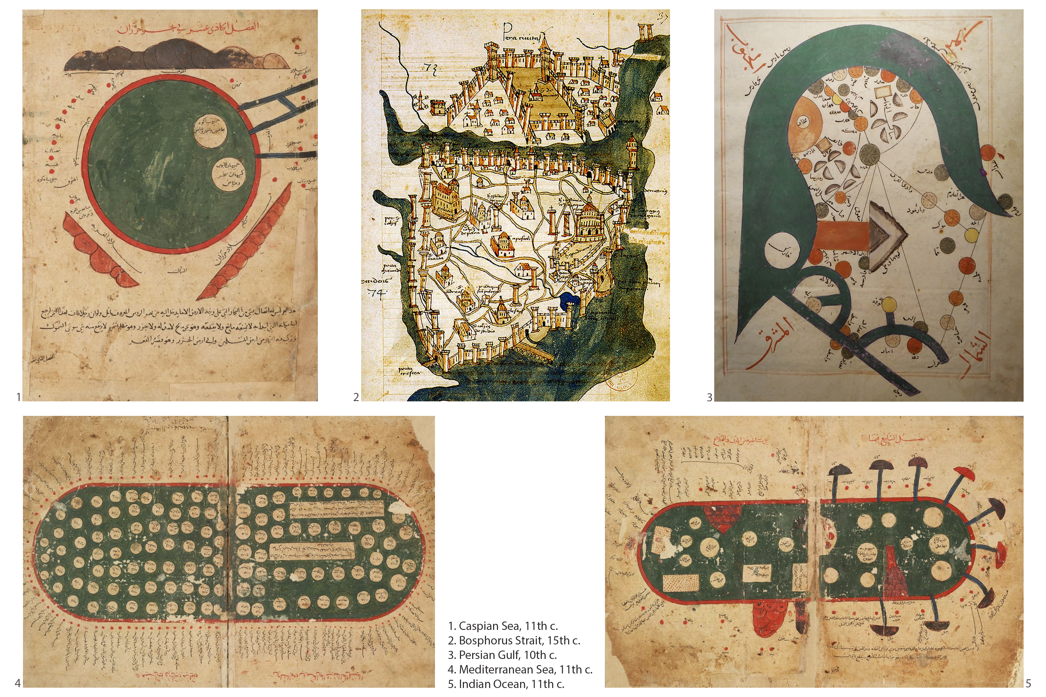
Medieval Maps, Waters of Life, Waters of Death, 2016
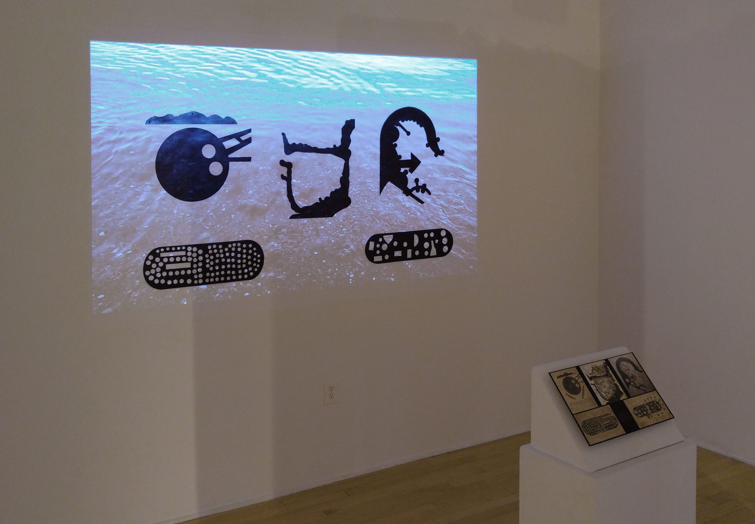
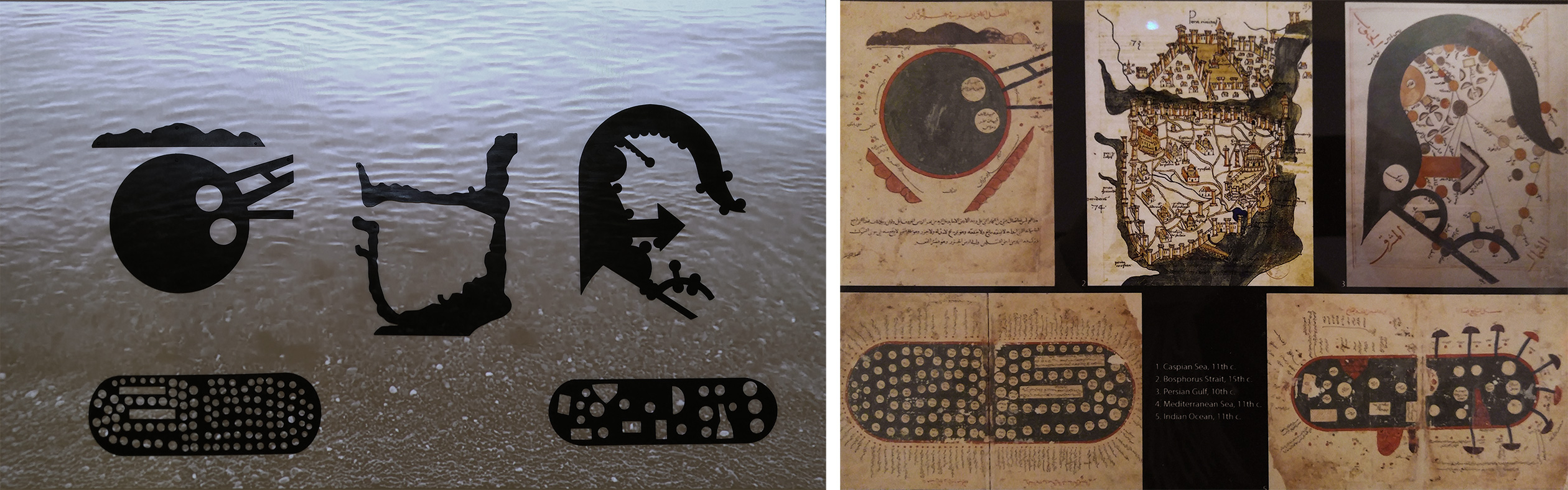
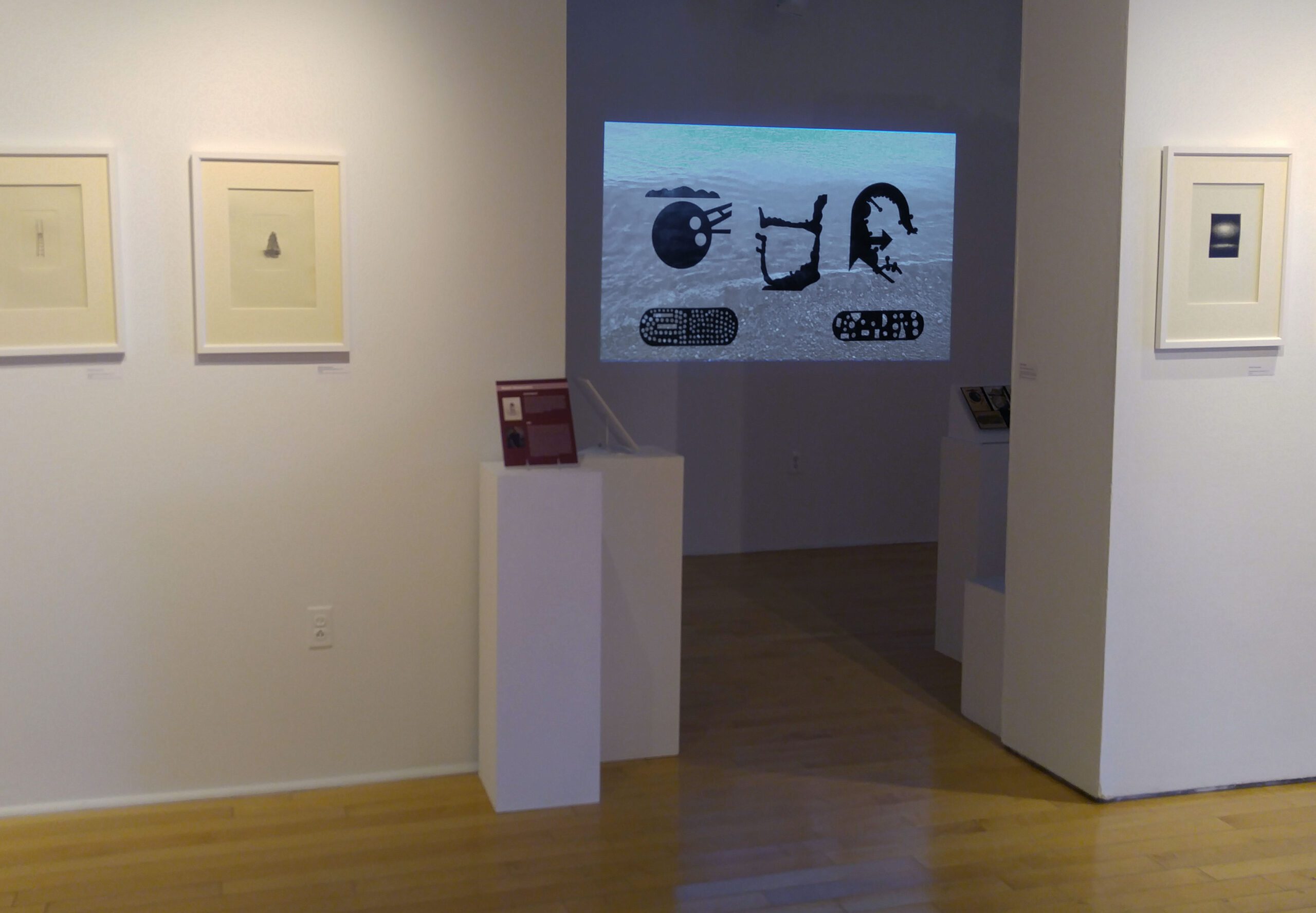
Waters of Life, Waters of Death, 2016, showcases the silhouettes of the medieval maps of four major bodies of water in the Middle East and the Mediterranean. The pieces are accompanied by a video projection of the moving waves. The movements of the waves coming to the shore stand as a metaphor for the plight of the Syrian and Afghan refugees who frequently cross these waters on small, rickety smuggler boats to reach Europe, even at the cost of possibly being drowned. These bodies of water were historically sources of life and prosperity, and they facilitated exchanges of goods and ideas across the Middle East and Europe. Juxtaposing today’s waters against their images in historical times, I allude to the ironic contrast between today’s socio-economic and political circumstances and those of historic times. The silhouettes are modeled after maps in The Book of Curiosities of the Sciences and Marvels for the Eyes by an 11th c. Arab cartographer and Routes and Realms by Estakhri, a 10th c. geographer and traveler.
Maps: the Caspian Sea, Bosphorus Strait, Gulf of Oman, Indian Ocean, and the Mediterranean Sea

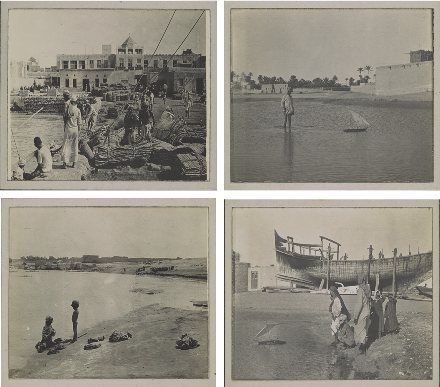
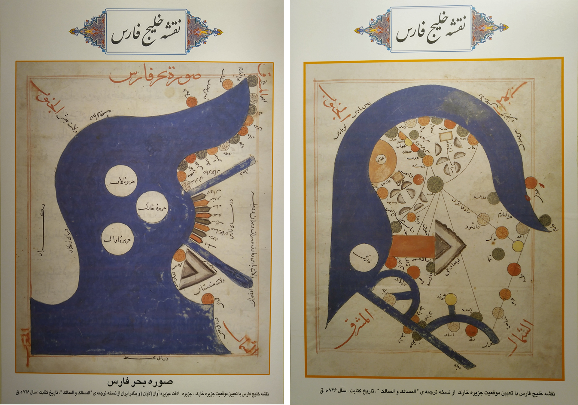
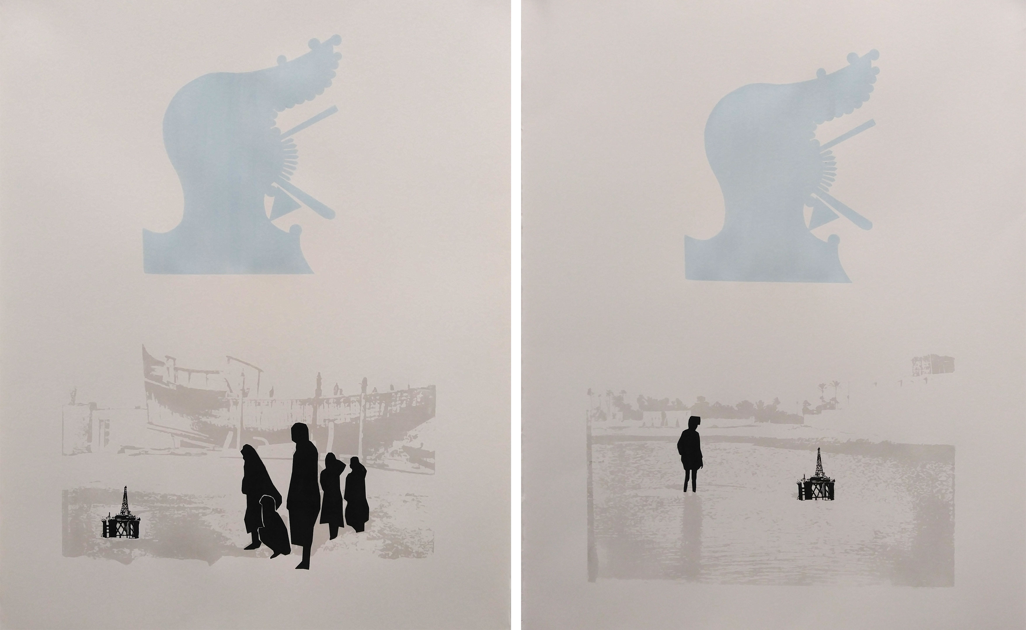
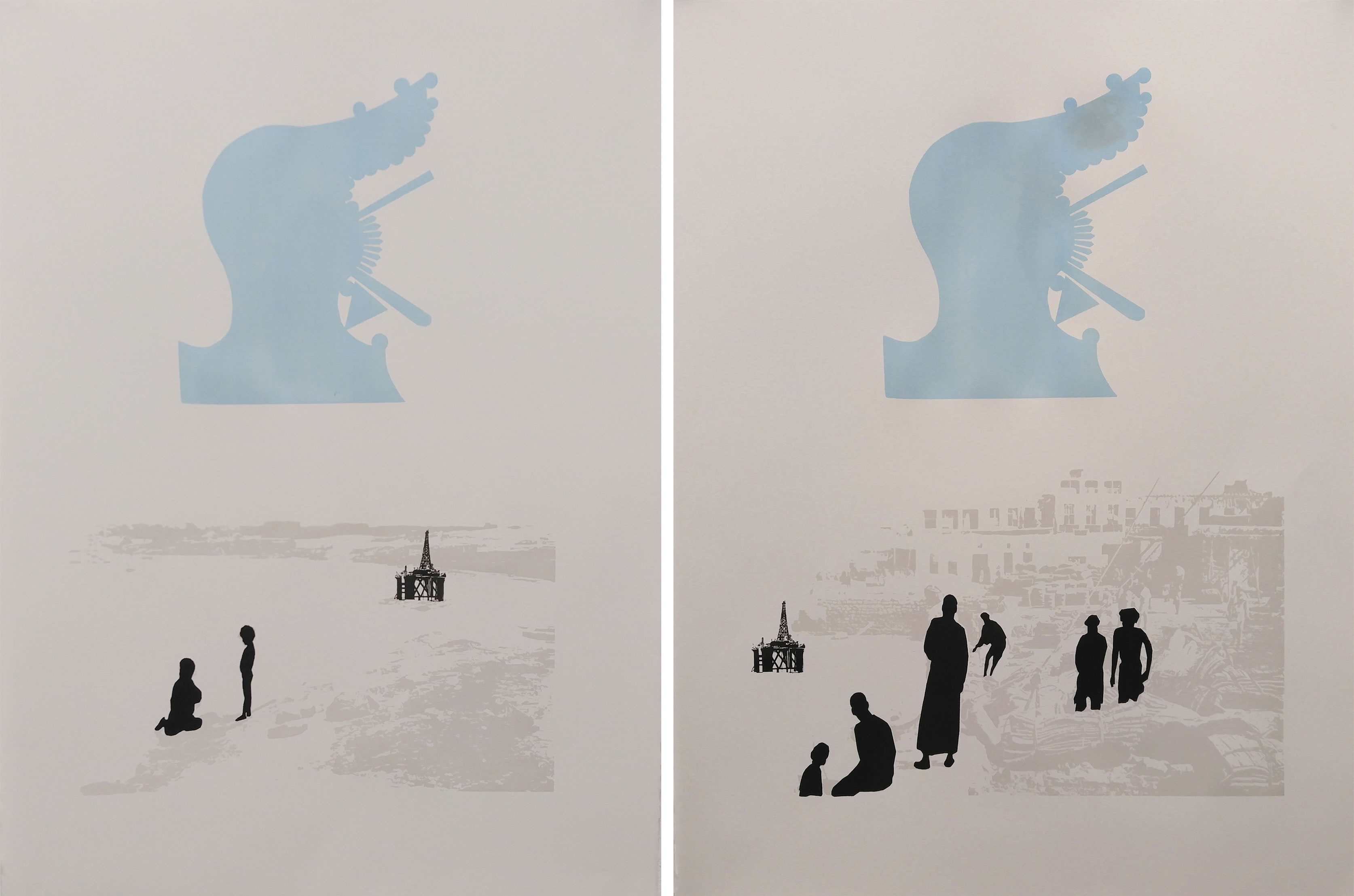
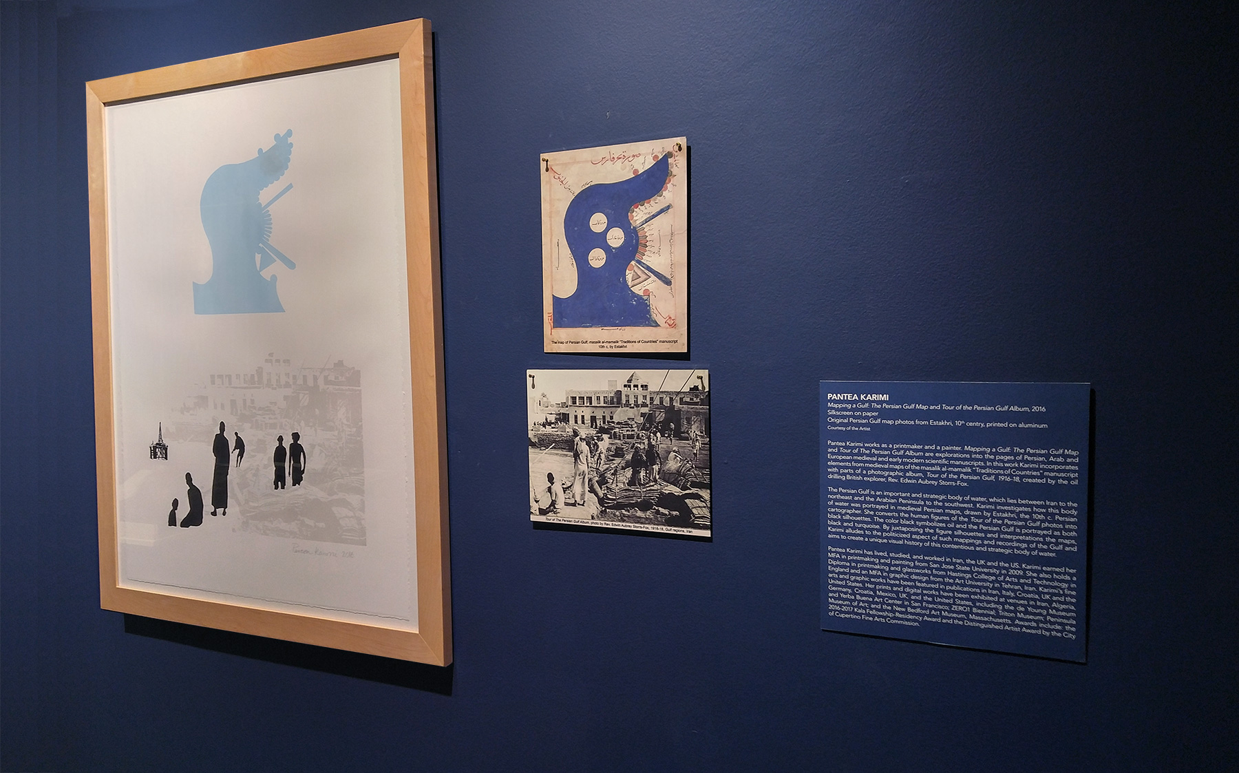
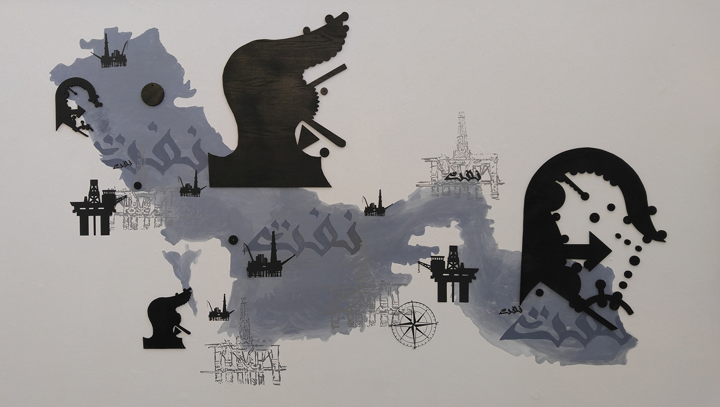
Mapping a Gulf: The Persian Gulf and Tour of The Persian Gulf Album, 2016
Mapping a Gulf: The Persian Gulf Map and Tour of The Persian Gulf Album prints explore the history of territorial boundaries of the Persian Gulf regions through medieval maps of the masalik al-mamalik (Routes and Realms) manuscript and the photographic album, Tour of the Persian Gulf, 1916-18. Tour of the Persian Gulf is the photographic album of a British explorer, Rev. Edwin Aubrey Storrs-Fox, who resided in the area to drill oil. In these prints, I am looking at how the body of water, otherwise known as the Persian Gulf, was portrayed in medieval Persian maps, which was drawn in Estakhri’s 10th c. manuscript. The Persian Gulf is an important and strategic body of water, which lies between Iran to the northeast and the Arabian Peninsula to the southwest. I convert the Persian Gulf maps and the human figures of the Tour of the Persian Gulf photos into black silhouettes. By juxtaposing the black silhouettes that emerge from both the album and the maps, I allude to the politicized aspect of such mappings and recordings of the Gulf and aim to create a visual history of this strategic body of water. In these prints, the color black symbolizes oil, and the Persian Gulf water is portrayed in both black and turquoise colors.
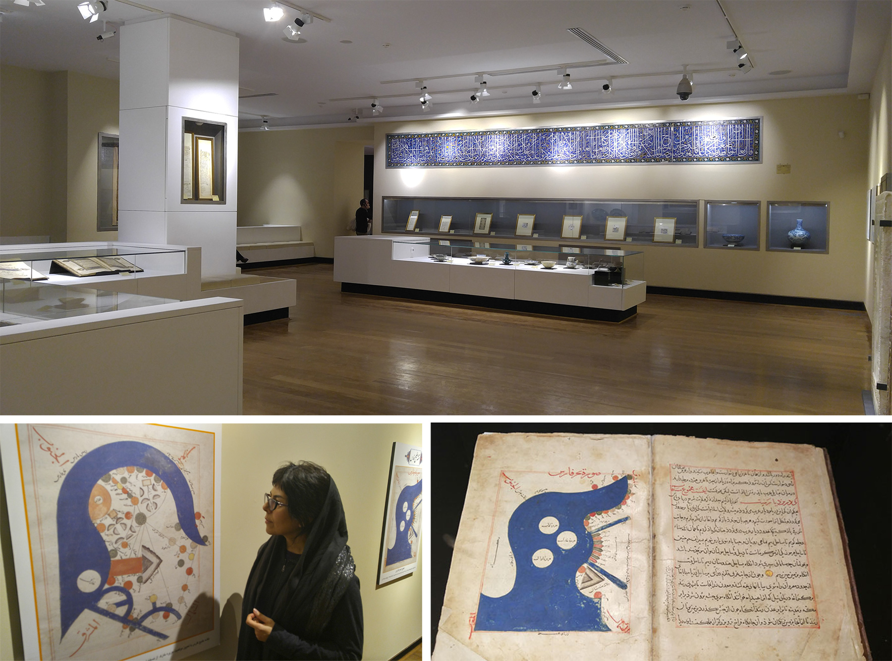
Research
The Islamic Document Museum and Malek Library
Tehran, Iran, 2016